We have students all over the United States and the world taking our online courses in open source mapping. We are proud of our geographic diversity! If you are interested in learning how to map, please let us know.
View map fullscreen
We have students all over the United States and the world taking our online courses in open source mapping. We are proud of our geographic diversity! If you are interested in learning how to map, please let us know.
View map fullscreen

By Hannah Edelen
Charles Altendorf, a 2011 University of Kentucky alumnus, is using the skills he developed and honed as a geography student in the College of Arts & Sciences to help improve the mapping system at his current job with the Hardin County Water District No. 1. Working on a pilot project, Altendorf is attempting to convert the water district’s data analysis from traditional digital mapping to an open source method.
From a young age, Altendorf was drawn to maps and mapmaking. “When I was a kid, I would get a new Rand McNally Atlas every year,” he said. However, Altendorf began his time at UK as an engineering major, partly because he was never exposed to geography courses in high school and was not aware that it was possible to study geography professionally. “After struggling my first year at UK, I realized you could major in geography,” Altendorf said

By Madison Dyment
Kerry Gathers’ map detailed the economic impact of the whaling industry throughout the 19th century.
Kerry Gathers, a student in the New Maps Plus online graduate program in the University of Kentucky College of Arts and Sciences, recently received the national first prize in the Dynamic Map competition at the North American Cartographic Information Society annual meeting.
Gathers’ map detailed the economic impact of the whaling industry throughout the 19th century. To properly map out this information, he drew upon past records of historic American whaling voyages through a database.
“I've been interested in the history of whaling since reading 'Moby Dick,' which inspired me to read more and more
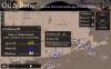
At the 2018 North American Cartographic Information Society (NACIS) annual meeting, New Maps Plus student Kerry Gathers was awarded first prize in the student Dynamic Map competition. Kerry's beautifully stylized and interactive map (https://www.kgmaps.com/oil-and-bone/) highlights the rise and fall of the whaling industry of the 1800's, and includes fascinating narratives at key points. Well done Kerry!
